Karpeles Manuscript Library Museum
June 5, 2020
Big Bog State Recreation Area
June 5, 2020Are you looking for a place to explore, an adventure that involves hiking, rock climbing, or biking? You will find it when you visit Ely’s Peak in Duluth. It is named for Edmund F. Ely, a Presbyterian missionary from 1833. Ely was was originally from Massachusetts and began teaching in 1834 in the Fond du Lac Native American community. He helped in the early establishment of what has become the city of Duluth.
At Ely’s Peak, you will find two hiking options, the Superior Hiking Trail and the Spur Trail which is a 300-ft climb the peak. The Superior Hiking Trail goes around the peak to the top and is easier to travel. These two trails, and the many smaller trails that branch off from the main trails, provide miles of hiking. You can continue to follow the Superior Hiking trail up the North Shore once you reach the peak.
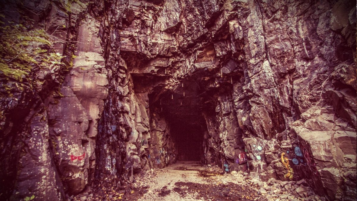
While you are hiking you will encounter an abandoned train tunnel that goes through the rock in the peak. It was frequently used by the Duluth, Winnipeg and Pacific Railway (DWP) in the ’80s. You will want to be sure to bring your flashlight as you walk the approximately 520’ long and 18’ wide tunnel which has a curve and is dark in the middle.
If rock climbing is your thing, Ely’s Peak offers 18 routes for you to choose from. Climbs are short and relatively straight forward with a mix of crack and face climbing on solid basalt. The abandoned train tunnel is also popular with rock climbers.
The sights you experience as you travel Ely’s Peak are breathtaking. You can see for miles above the trees with a view of the St. Louis River and Western Duluth. When you reach the top, you will enjoy even more of the vast beauty Duluth has to offer. This is one adventure you won’t be disappointed you took!
Before You Go, Here’s A Tip
Some of the hiking paths are a bit challenging and rugged. The best way to find the train tunnel and peak is to follow these directions:
From Grand Avenue, you’ll turn onto Becks Road. You will find a small parking lot located about 2 miles north on the right-hand side.
If you are coming from I35 you will take the Midway Road exit and go south for 2 miles. The parking lot will be on your left.
From this small parking lot, you will find a wooden boardwalk that leads into the woods. Follow this path until you come to the old railroad path. Take this to the right and it will lead you directly to the tunnel. There are many trails that head off before you reach the tunnel and more you can explore after you go through the tunnel.
Once you go through the tunnel you will want to stay on the main trail that goes to the right. You can take the smaller trail that takes you straight up the peak. The bigger trail will wrap around the peak and also bring you to the top. You are on the Superior Hiking Trail. It is marked with blue lines. It will eventually fork and you should see small signs. You’ll want to keep left. Follow the blue markings and you should reach the peak!


